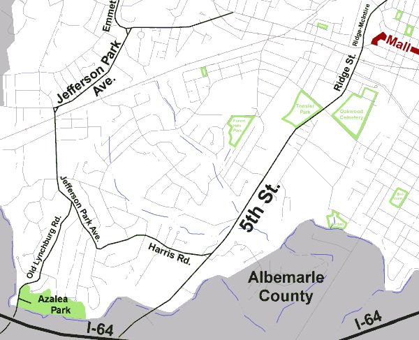
| Map to Azalea Park |
|
| Azalea Park is located off Old Lynchburg Road
at the southwestern edge of the City near Interstate 64. Off-street
parking is available.
From the Downtown Mall: Take Ridge Street south onto 5th Street, continue some distance and turn right onto Harris Road. Proceed several blocks and turn right onto Jefferson Park Avenue, travel a few blocks and turn left onto Old Lynchburg Road. Travel south past the sharp turn and the park is abruptly on the left. From Route 250: Head south on Emmet Street onto Jefferson Park Avenue, continue south and turn left onto Jefferson Park Avenue Extended and continue a few blocks. Turn right onto Old Lynchburg Road, travel south past the sharp turn and the park is abruptly on the left. |
 |
Revised 1/11/02 by Stowe Keller
 Charlottesville
City Home Page
Charlottesville
City Home Page