| Map to
Rives Park |
|
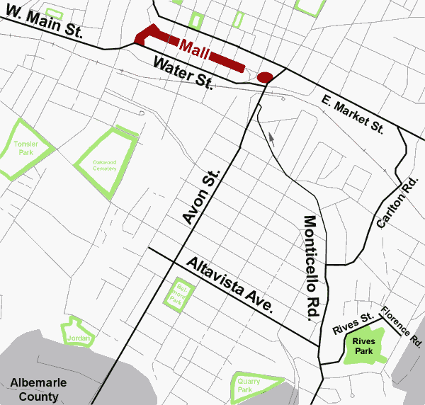
| Rives Park is located on Rives Street between
Monticello and Florence Roads on the southeastern side of Charlottesville.
Off-street parking is available.
From the Downtown Mall: From the east end of the Mall head east on East Market Street, turn right onto Carlton Road, then left onto Monticello Road and left onto Rives Street and the park is on the right. From Route 250 and Route 29: Head south on Emmet Street and turn left onto University Avenue and continue onto West Main Street and onto Water Street. Travel several blocks and turn right to cross the bridge over the railroad tracks onto Avon Street, travel about 8 blocks and turn left onto Altavista. Continue several blocks and turn right onto Monticello Road and turn left on Rives Street and the park is on the right. |
 |
Revised 4/15/01 by Stowe Keller
 Charlottesville
City Home Page
Charlottesville
City Home Page